Where the Valley Sits
The Kathmandu Valley lies in Nepal, being a bowl-shaped basin that lies between three districts namely Kathmandu, Lalitpur and Bhaktapur. It is located in central Nepal and sits 1,300 to 1,400 meters above sea level. The valley is enclosed by four major hill ranges namely Shivapuri (2,732 meters high), Phulchowki (2,760 meters high), the highest range along the rim, and Chandragiri (2,551 meters high) to the southwest. Lastly there is Nagarjun to the northwest of the valley. Bagmati River passes right through the center of the valley, traditionally serving as the backbone of the temples, bathing ghats and other settlements in the valley. While Eastern and Far Western regions are described based on distance from the capital city, the current region is based on concentration of former capitals and heritage sites.
Three Durbar Squares
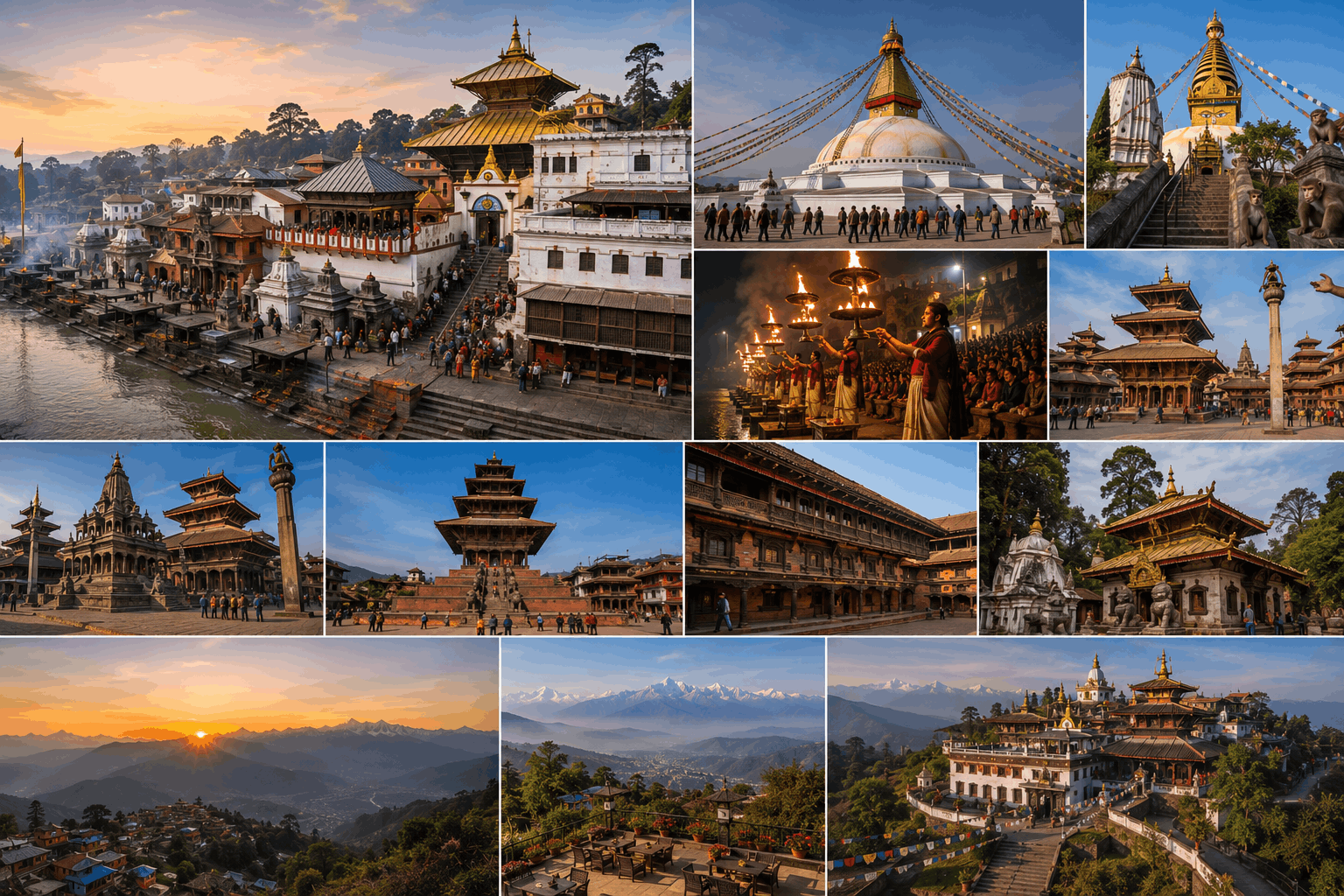
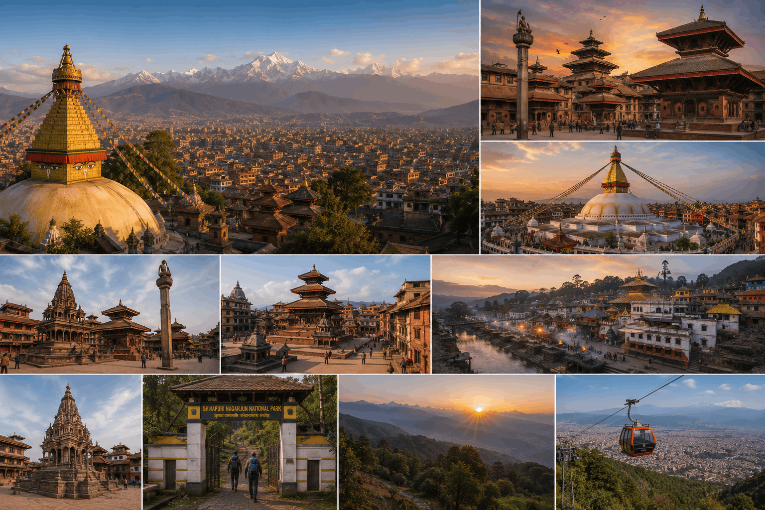
From 1768 until the present day, the valley was divided into three competing Malla kingdoms, with each possessing its own royal palace square called Durbar Square. The Gorkha army under King Prithvi Narayan Shah conquered Kathmandu in 1768. On the occasion of Indra Jatra festival, he annexed Patan and Bhaktapur to form the Kingdom of Nepal by 1769, thereby putting an end to the four-century-long reign of Mallas. Kathmandu Durbar Square (Hanuman Dhoka), located in the heart of the old city, functioned as a place of residence for the Malla and Shah rulers. Patan Durbar Square in Lalitpur houses the richest collection of Newar temples in the valley. Bhaktapur Durbar Square, the farthest from the contemporary city center, preserves more medieval brick paving pattern than any of the other two squares. All three are still functioning districts, where markets, temples, and Newar families function within the very courtyards that tourists are walking around in.
Seven Monument Zones, One World Heritage Site
In addition to the three Durbar Squares, four more religious zones make up the list of UNESCO World Heritage Sites in the valley, all of them combined into a single World Heritage zone since 1979. Swayambhunath is the valley's ancient Buddhist stupa built on top of the hill, providing a great view of the entire city. Boudhanath is the largest stupa in Nepal and the center of its Tibetan Buddhism, located in the eastern part of the valley. Changu Narayan is the valley's oldest extant temple complex, featuring an inscription dating back to the 5th century AD, the earliest one found in the valley. Lastly, Pashupatinath is one of the major Hindu temple complexes in South Asia, located on the banks of the Bagmati River. All of them are easily accessible from central Kathmandu in less than an hour.
Valley Rim Day Hikes
The mountains surrounding the valley are also the most scenic viewing points of the valley and can be visited on a half day walk from the city. Nagarkot, 32 kilometers east at 2,175 meters, is the well-known sunrise viewing point of the valley and provides views even up to the mountain of Everest. Chandragiri is southwest of the city and can be accessed by both cable car and walking trails. Shivapuri Nagarjun National Park was established in 2002 and spans across 159 square kilometers north of the valley. This park helps in conservation of the catchment area that supplies the valley with its water resources and includes the mountain peak of Shivapuri, which is 2,732 meters high.
Why Every Nepal Trip Starts Here
Nepal's most used international airport is located within the valley, in Kathmandu proper. This is in contrast to other regions like eastern and far western Nepal where the trip always starts with another domestic flight or a lengthy drive from the capital. The Kathmandu valley is where most trips to Nepal start and end, with most trekkers spending a day or two in the valley before flying out to the trails and coming back for one or two more days upon return from the trek. For those who are not going trekking at all, the valley can be the full destination in itself for a three or four-day tour.
Best time to visit:
October to November, during post-monsoon clear weather and the Dashain and Tihar festivals, or February to April when it's still spring. The valley, unlike other trekking areas located at higher elevations, is visitable all year round, including the monsoon (June to September), which brings clouds and rains, obscuring the mountains from the viewpoints but not closing the valley.